A Comprehensive Exploration of World Maps: Charting Our Global Understanding
World maps are graphical representations of the Earth's surface, depicting geographical features, political boundaries, and various thematic elements. These maps provide a comprehensive view of the planet, showcasing continents, countries, oceans, and major cities. They are essential tools for understanding global geography, facilitating navigation, and planning travel. World maps come in various projections, such as the Mercator, Robinson, and Winkel Tripel, each with its advantages and distortions. While traditional paper maps have been used for centuries, digital maps have become increasingly popular, offering interactive features and real-time data. Beyond their practical applications, world maps also serve educational purposes, helping people visualize and comprehend complex global relationships and environmental issues. They remain vital instruments in academics, education, and global awareness.

Introduction
World maps have long been more than just tools for navigation; they are windows into human history, culture, and our evolving understanding of the planet. From ancient cartography to modern digital maps, each iteration reflects the technological advancements and conceptual shifts of its time. This review delves into the various facets of world maps, examining their historical significance, practical applications, artistic elements, and the ongoing challenges in map-making.
Historical Significance
The history of world maps is a fascinating journey through human civilization. Early maps, such as those created by the Babylonians on clay tablets, were more symbolic than accurate. They primarily served religious or mythological purposes, depicting the world as a flat disc surrounded by a world ocean. The Greeks, particularly figures like Ptolemy, made significant strides in cartography by incorporating mathematical principles and observations, laying the groundwork for future map-making.
The Age of Exploration in the 15th and 16th centuries marked a pivotal era for world maps. Explorers like Christopher Columbus and Ferdinand Magellan relied on increasingly accurate maps to navigate uncharted territories. The invention of the printing press allowed for the widespread distribution of maps, democratizing access to geographical knowledge. These maps not only facilitated exploration but also played a crucial role in colonial expansion, often at the expense of indigenous populations.
Practical Applications
In the modern era, world maps serve a plethora of practical applications. They are indispensable tools in education, helping students grasp the concept of geography and the spatial relationships between countries and continents. In the field of logistics and transportation, maps are crucial for planning routes and optimizing travel time. Similarly, in disaster management, maps are used to assess risk areas and coordinate relief efforts.
Digital maps have revolutionized the way we interact with the world. Platforms like Google Maps and GPS technology have made navigation more accessible and accurate than ever before. These tools incorporate real-time data, offering dynamic updates on traffic conditions, weather, and points of interest. The integration of Geographic Information Systems (GIS) has further enhanced the analytical capabilities of maps, enabling detailed spatial analysis for urban planning, environmental conservation, and resource management.
Artistic Elements
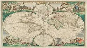
Beyond their functional value, world maps are also appreciated for their artistic elements. Antique maps, with their intricate designs and decorative flourishes, are considered works of art and are highly sought after by collectors. The artistry in these maps often reflects the culture and worldview of the time, incorporating fantastical creatures, elaborate cartouches, and ornate compass roses.
Contemporary maps continue to push the boundaries of cartographic art. Artists and designers experiment with various styles and media, from minimalist designs to complex data visualizations. These modern interpretations not only provide geographical information but also evoke emotional responses and provoke thought. For instance, maps that highlight social or environmental issues can raise awareness and inspire action.
Challenges in Map-Making
Despite the advancements in technology, map-making continues to face several challenges. One of the most persistent issues is the distortion inherent in projecting a three-dimensional sphere onto a two-dimensional plane. Various projection methods, such as the Mercator, Robinson, and Winkel Tripel, offer different compromises between accuracy in shape, area, distance, and direction. Each projection has its strengths and weaknesses, and the choice often depends on the map's intended use.
Another challenge is the representation of disputed territories. Political boundaries are often fluid, and maps can become outdated quickly due to geopolitical changes. Cartographers must navigate the delicate task of depicting these areas in a way that is both accurate and sensitive to the differing perspectives of the involved parties.
Furthermore, the digital age has introduced concerns about data privacy and accuracy. While digital maps offer unprecedented convenience, they also collect vast amounts of user data, raising questions about privacy and data security. Additionally, the reliance on algorithms and automated processes can sometimes lead to errors or biases in the information presented.
Conclusion
World maps are more than mere representations of geographical spaces; they are reflections of our collective knowledge, culture, and technological progress. From their historical roots to their modern applications, maps have evolved to meet the changing needs of society. They serve as essential tools for education, navigation, and analysis, while also offering artistic and cultural value. However, the challenges in map-making remind us of the complexities involved in accurately portraying our world. As technology continues to advance, the future of world maps promises even greater innovations, enhancing our understanding of the planet we call home.


